
On one trip we walked 2.5 miles to Laurel Falls, one of the most popular hikes in the park. There is a gradual ascent of 300 feet to the falls. The trail is paved, and the day we went it was very busy. It was a challenge to get a picture with no one in front of us.

The view on the way was, of course, trees!

The 80 foot falls is divided by a cement path. This is the top part.

This view looks down to the bottom part.

Some people climbed down to the bottom to look up, but we decided not to. We spoke to some folks after they climbed back up, and they said they could not see the whole falls from the bottom. We were glad that we wimped out and didn't miss too much.
On another occasion we took a trip to Clingman's Dome which is about 23 miles from Gatlinburg. In addition to being the highest point in the Great Smoky Mountains National Park at 6,643 feet, it is also the highest point in Tennessee and third highest spot east of the Mississippi. The seven mile drive to the parking area includes scenic pullouts with views of ridges and valleys and lots and lots of trees.

The half mile hike to the dome is quite steep, and we took several breaks along the way.

This is a view of Clingmans Dome from the top of the trail. There I am resting again!

After we circled to the top we were rewarded with a 360 degree view of the smokies. The clouds rolled in and out. There were descriptive pictures with the mountains pinpointed in the distance.

It was well worth the effort to see this beautiful spot.
The Appalachian Trail crosses Clingmans Dome marking the highest point along the trail from Georgia to Maine. We saw some "real" hikers who were on this journey and were quite impressed with their stamina.
One more popular spot is the Cades Cove Loop, an 11 mile loop on the eastern side of the park. There are 17 stops along the way with homes, churches, historical area, and visitor center. The area was settled in the early to mid 1800's and the buildings were all built at that time. Several homes were open for viewing. The churches included cemeteries in the back yard.

Inside the furnishings were very basic.

We stopped at many of the homes and churches but spent most of the time at the cable mill area including the visitor center. It was built to fit into the era.

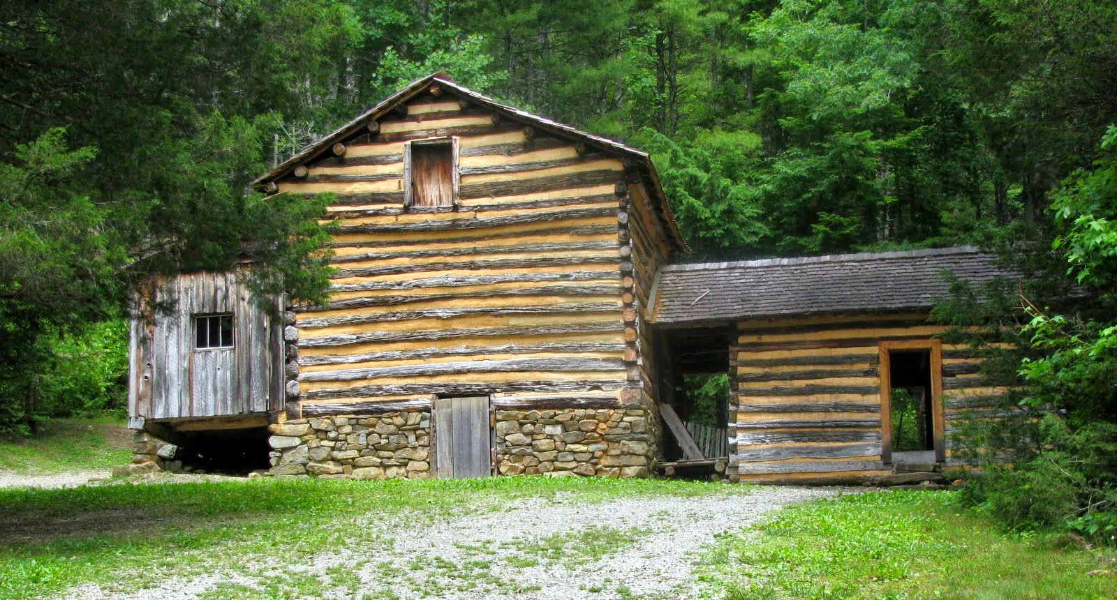
There was a very interesting barn where farmers sheltered livestock and farm equipment in the winter.

Another barn was an unusual shape.

At the Grist Mill workers were grinding corn and selling corn meal.

There was a corn crib

and the farmhouse.
The view of the Smoky Mountains was a little different from this area of the park.

Although it is hard to imagine life back in the 1800's in eastern Tennessee, the trip through Cades Cove gave us a good idea of what it was like.
At this point we are on the downhill part of our summer adventure. Since Monday, August 4, Dollywood closes at 7 pm instead of 10 pm. After next week it will be closed on Wednesday and Thursday. We only have four more weeks of work. They say that things slow down on the rides once the kids go back to school. There are many more attractions that we want to see in the area and hope to do on our days off.
Enjoyed your post and beautiful photos! Glad you are able to visit some of the beauty spots of the Smokey Mountains and share with us.
ReplyDelete